


HULL - T 1 Voting District, Portage County, Wisconsin
About
Outline

Summary
| Unique Area Identifier | 696286 |
| Name | HULL - T 1 Voting District |
| County | Portage County |
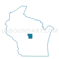
| State | Wisconsin |
| Area (square miles) | 2.09 |
| Land Area (square miles) | 2.07 |
| Water Area (square miles) | 0.02 |
| % of Land Area | 99.25 |
| % of Water Area | 0.75 |
| Latitude of the Internal Point | 44.56225890 |
| Longtitude of the Internal Point | -89.54603750 |
Maps


Graphs
Select a template below for downloading or customizing gragh for HULL - T 1 Voting District, Portage County, Wisconsin


Neighbors
Neighoring Voting District (by Name) Neighboring Voting District on the Map
- HULL - T 2 Voting District, Portage County, WI
- HULL - T 3 Voting District, Portage County, WI
- HULL - T 4 Voting District, Portage County, WI
- HULL - T 5 Voting District, Portage County, WI
- Stevens Point - C 16 Voting District, Portage County, WI
- Stevens Point - C 21 Voting District, Portage County, WI